Water route


- 2:25 h
- 36.39 km
- 14 m
- 14 m
- 6 m
- Start: Apen, Augustfehn, Barßel
- Destination: Apen, Augustfehn, Barßel
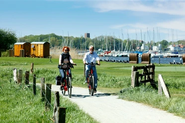
The ideal route for lovers of the wide fen landscape. On about 37 kilometers, you pass through a landscape that exudes more of an East Frisian rather than Ammerland flair. Numerous waterways accompany cyclists on their journey: Aper Tief, Nordloher Tief, Barßeler Tief, Südgeorgsfehn Canal, and Augustfehn Canal. Along the way, the residents of Apen have also installed two artworks at their favorite spots.
Highlights:
- Ham Museum in Apen: The oldest ham-smoking facility of Ammerland can be found in the centre of Apen. Here, the owner Arnd Müller guides visitors through the Ham Museum, where he himself, in the ninth generation, still smokes ham according to ancient tradition.
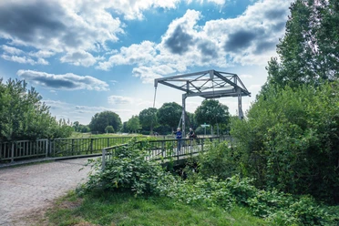
- The nature reserve Aper Tief (Hengstforde) is the largest tidal watercourse in Ammerland with direct access to the North Sea. This wetland and flood area, newly created in 2005, fascinates with its daily changing moods and views. With nine "rather quirky" colorful birds made of metal, the artist Jörg Ridderbusch has here put a monument to the bluethroats, marsh, pond and reed warblers, fieldfares and redshanks that breed in spring in the Aper Tief. Another artwork with dancing sheep is located on Brückenweg directly opposite a shelter.
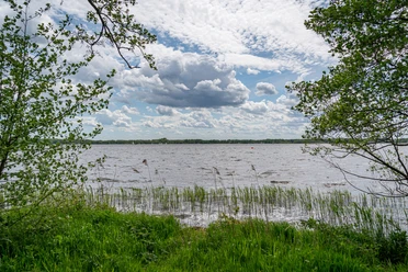
- The landscape window "Water" (Tange) is one of five landscape windows in Ammerland. The lookout towers were built in 2002 and point out the special features of the region. The "Tower of the Dike Keeper" in the district of Tange stands as a symbol of the region's wealth of water.

Good to know
Best to visit
Directions
Directions & Parking facilities
A28 / A29/ A31
Your arrival by car follows the A1 and A29 motorways to Oldenburg, and from Oldenburg continue along the A28 towards Emden/Leer to Westerstede or your desired destination in Ammerland.
You can conveniently arrive by train at the following stations in Ammerland and the region.
Stations: Leer, Augustfehn, Westerstede-Ocholt, Bad Zwischenahn, Oldenburg, Rastede
The other towns and districts can easily be reached by bus.
License (master data)

Author´s Tip / Recommendation of the author
Map
Nearby


Download GPX file