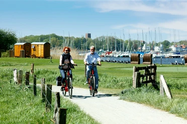
Moor route


- 3:40 h
- 57.70 km
- 25 m
- 25 m
- 3 m
- 12 m
- 9 m
- Start: Bad Zwischenahn, Edewecht
- Destination: Edewecht, Bad Zwischenahn
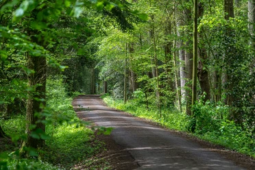
The region-typical Fehn settlements in Ammerland belong to a last wave of colonization in the 18th century to develop the moor areas. It goes along green, sparsely populated residential streets, moor meadows, and some colorful wild meadows. The route is characterized by easily rideable, straight moor paths, which lead through the vast Fehn area around Petersfehn and along the coastal canal. The new route now also passes through the Fintland Moor. Particularly worth seeing is the Moor information point in the Kayhauser Moor area.
Highlights to the right and left of the route
- The coastal canal is a federal waterway about 70 kilometers long. It branches off the Hunte in Oldenburg and meets the Dortmund-Ems Canal near Dörpen.
- Small railway hiking trail: From 1912 to 1991, the small railway ran here from Edewechterdamm to Bad Zwischenahn on a route length of about twelve kilometers. Functions of the railway line were the transport of peat, which was also used as a fuel for locomotives at that time, as well as the transport of cattle. However, the decades-long profitable freight traffic steadily declined, so that in the early 1990s the tracks were dismantled and the line became a cycling path.
- The Fintland Moor is a drained and largely peat-extracted raised bog area and has been under nature protection since 1987. In 2017, the area was divided into the nature reserves "Fintland Moor" and "Dänikhorst Moor." Through sand dams and weirs in the drainage ditches, renaturation through rewetting is being pursued in both areas.
- Moor information point (Kayhausen): A central viewing point is a glass stele on an excavated peat wall, which impressively shows how the raised bog has developed over the last 7,000 years. The information point aims to raise awareness of an extremely endangered and sensitive habitat.
- The large Engelsmeer (Kayhauserfeld) is a two-hectare area with a moor lake and a partially wide reed belt.

Good to know
Pavements
Best to visit
Directions
Equipment
Directions & Parking facilities
A28 / A29 / A31
Your arrival by car takes place along the A1 and A29 highways to Oldenburg and from Oldenburg continue along the A28 towards Emden/Leer to Westerstede or your desired destination in Ammerland.
You can comfortably arrive by train at the following stations in Ammerland and the region.
Stations: Augustfehn, Westerstede-Ocholt, Bad Zwischenahn, Oldenburg, Rastede
The other towns and districts can be easily reached by bus.
License (master data)

Author´s Tip / Recommendation of the author
Safety guidelines
Map
You can order the overview map and the cycling map set with all 15 themed routes here for the price of 7.90 € plus postage. The individual maps have a scale of 1 : 30,000.
Nearby


Download GPX file